Navigating public transportation in Detroit can feel like a maze if you’re not familiar with the city. But don’t worry, I’ve got your back. I remember my first time trying to figure out the bus schedules and routes—it was a bit overwhelming, to say the least.
Thankfully, after a few mishaps and a lot of learning, I’ve managed to get a good handle on how to move around the Motor City efficiently. Whether you’re a local looking to ditch the car for a day or a visitor eager to explore, I’ll share some tips that’ll make your journey smoother and maybe even enjoyable. So, let’s dive in and get you ready to navigate Detroit’s public transportation like a pro.
Planning Your Route
When I first decided to tackle the public transportation system in Detroit, I was a bit lost. There’s nothing quite like the feeling of looking at bus schedules and route maps, trying to figure out how they all connect. But trust me, with a bit of planning, it becomes a lot more manageable. Here’s how I do it.
First, I always check the schedules ahead of time. Detroit’s public transportation system, particularly the Detroit Department of Transportation (DDOT) and the QLINE, offers specific route information online and through their apps. I’ve found that knowing the bus or streetcar schedules before heading out saves a lot of waiting time and uncertainty.
Key Tools for Planning:
- DDOT Website and App: For bus routes and schedules.
- QLINE Website and App: For streetcar routes and timing.
It’s also crucial to plan for transfers. Sometimes, to get where I’m going, I need to switch buses or jump on the QLINE. In those cases, understanding the connection points and timing is essential to ensure a smooth transition. I always look up potential transfer points and give myself a buffer time just in case there are delays.
Another tip I’ve picked up is always having a backup plan. Especially during the winter months or late at night, services can be less frequent. I make sure I know a couple of different routes to my destination, just in case the direct route isn’t available.
Using real-time tracking apps has also been a game-changer for me. Apps like Transit and Moovit provide real-time updates on when the next bus or streetcar will arrive, which helps me minimize waiting time.
- Transit
- Moovit
Lastly, don’t be afraid to ask for help. Detroiters are incredibly friendly, and I’ve found that bus drivers and fellow passengers are usually more than willing to help if you’re confused about your route.
Navigating public transportation in any city can be a challenge at first, but with these planning tips, I’ve found my trips around Detroit to be much more enjoyable and efficient. And remember, the more you use the system, the easier it gets. Each trip helps me learn something new, whether it’s a faster route or a hidden gem of a stop I never knew existed.
Understanding the Fare System
Navigating the fare system in Detroit’s public transportation is akin to solving a puzzle—it can be complex but is definitely manageable once you get the hang of it. My first tip to anyone stepping into this arena is to familiarize yourself with the different fare options. Each mode of transportation, be it DDOT buses, the QLINE, or the People Mover, operates on its own fare structure. It’s crucial to know the specifics to maximize both convenience and cost-efficiency.
For starters, single rides on DDOT buses cost $2, which is pretty standard fare for city buses. However, the game-changer for me was discovering the Dart passes. These passes offer unlimited rides across different services including DDOT and QLINE, making them perfect for those planning multiple trips or transfers in a day. Dart passes come in several durations:
| Duration | Price |
|---|---|
| 4 Hours | $2 |
| 24 Hours | $5 |
| 7 Days | $22 |
| 31 Days | $70 |
Purchasing passes has never been easier with the advent of mobile apps. I personally use the DDOT mobile app, where I can buy and store my tickets digitally—no more fumbling for change!
One essential piece of advice I’d give is to keep track of your pass expiration. There’s nothing quite like the dread of realizing your pass expired mid-journey. I set reminders on my phone, which has been a lifesaver on more than one occasion.
Another key aspect I found immensely helpful is the reduced fare program for eligible riders, including seniors, students, and persons with disabilities. If you qualify, don’t hesitate to apply. The savings are significant.
Lastly, if you’re ever confused or unsure about fares, ask a bus driver or a fellow passenger for help. My experiences have taught me that Detroiters are incredibly friendly and willing to lend a hand. Plus, it’s a great way to connect and hear the pulse of the city directly from its residents.
By taking some time to understand the fare system, I’ve saved money and minimized the hassle in my commutes. It’s all about knowing your options and making the system work for you.
Mastering the Bus Schedule
After getting a good grasp on the fare system, it’s essential to dive into mastering the bus schedules of Detroit’s DDOT. This might seem daunting at first, but with a few tips and tricks, I’ve found it to be quite straightforward and incredibly helpful for planning my journeys.
The key is to always check the most current schedules. Detroit’s DDOT updates their schedules periodically to reflect changes in service or to improve efficiency. I’ve made it a habit to check the DDOT website or the mobile app for the latest updates before any trip. This small step saves me from unnecessary waits at the bus stop and ensures I’m always on the best route for my destination.
Another strategy I’ve adopted is familiarizing myself with the major bus routes and their frequencies. Some routes, especially those that serve major arteries and popular destinations, have buses running more frequently. Knowing that the Woodward (Route 4) and Grand River (Route 3) have buses nearly every 10-15 minutes during peak times, while others might operate on a 30-60 minute schedule, helps me plan my departure times more effectively.
For those who prefer a more tech-savvy approach, I highly recommend using real-time bus tracking apps. These have been a game-changer for me. Real-time tracking allows you to see exactly where your bus is and how long until it reaches your stop. This technology has minimized my time waiting at bus stops and has made my public transport trips much more predictable.
Additionally, I’ve learned the importance of planning for the last bus of the night. There’s nothing worse than missing that last bus and being stranded. I always double-check the evening schedules, especially if I plan to be out late. Knowing the last bus times for my routes gives me peace of mind and allows me to enjoy my evening without worrying about how I’ll get home.
Lastly, engaging with the community has also proved invaluable. Online forums and social media groups dedicated to Detroit public transportation are fantastic resources for tips, updates, and firsthand experiences from fellow riders. Through these communities, I’ve learned some hacks for dealing with delays and the quickest routes for getting around the city.
Navigating Bus Transfers
When it comes to mastering the art of using public transportation in Detroit, understanding how to navigate bus transfers is crucial. Detroit’s bus system is complex, and if you’re planning on getting around the city efficiently, you’ll need to know not just your primary route, but also how and where to make your transfers.
One of the first things I learned was the importance of planning my route in advance. This doesn’t just mean knowing where I need to get off and transfer; it also means being aware of the schedules of the connecting buses. There’s nothing worse than getting off your first bus only to find out you’ve got a 30-minute wait for your next ride. To avoid this, I always check the DDOT website or app before heading out. It gives me a clear picture of the transfer times and helps me plan my journey more effectively.
Another tip I’ve found incredibly helpful is to ask the bus driver when boarding. This might seem a bit old school, but I’ve always found the DDOT drivers to be knowledgeable and helpful. If I’m unsure about where to transfer or which bus to take next, I’ll ask them as I pay my fare. More often than not, they’ve been able to give me useful advice or at least confirm that I’m on the right track.
Additionally, I’ve made it a habit to utilize real-time bus tracking apps. Apps like Transit and Moovit have been lifesavers for me, especially when dealing with transfers. They provide real-time updates on bus locations, allowing me to adjust my plans on the fly if there are any delays or changes in the schedule.
Lastly, I always prepare for the unexpected. Whether it’s a sudden change in the weather or an unexpected disruption in service, having a backup plan is essential. I usually have a couple of alternative routes in mind and keep an eye on transit alerts through the DDOT app. That way, if something goes wrong with my planned transfer, I’m not left stranded.
By integrating these strategies into my routine, I’ve found that navigating bus transfers in Detroit doesn’t have to be a daunting task. With a bit of preparation and the right tools at my disposal, I’ve been able to move around the city with relative ease. And remember, every experience is a learning opportunity. The more you use the system, the more comfortable and proficient you’ll become at making those necessary transfers.
Exploring Other Transportation Options
While mastering bus transfers was a game-changer for me, I quickly realized that having a few more tricks up my sleeve could make my travels in Detroit even smoother. Exploring other transportation options became part of my adventure in the city, and I’m excited to share what I’ve learned with you.
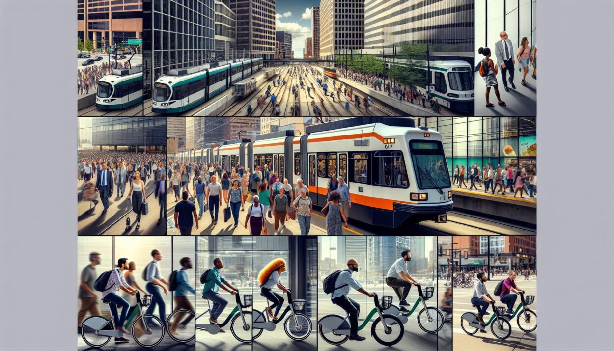
First off, let’s talk about the Detroit People Mover. This automated light rail system circles downtown Detroit and is a fantastic way to get a bird’s-eye view of the city. It’s especially helpful for reaching destinations that are just a tad too far to walk from bus stops. The cost is minimal, and the stations are well-marked. I found it to be a convenient option for quick hops around downtown.
Another service I came to appreciate is the QLine streetcar. It runs along Woodward Avenue, connecting downtown Detroit to the New Center area. The QLine is not only efficient but also comfortable and offers Wi-Fi. It’s perfect for when I want to relax a bit more on my journey or need to check my email on the go. Plus, it intersects with several bus routes, making transfers between different modes of transportation seamless.
For those who prefer biking, the MoGo bike-sharing system is a godsend. Stations are located throughout the city, making it easy to pick up and drop off bikes as needed. I’ve found MoGo to be an excellent option for nice days when I feel like getting some exercise or just want to enjoy the outdoors while traveling. It’s also a great way to discover hidden gems in the city that I might miss when using motorized transportation.
| Transportation Option | Pros | Cons |
|---|---|---|
| Detroit People Mover | Covers downtown area, inexpensive | Limited reach beyond downtown |
| QLine Streetcar | Comfortable, offers Wi-Fi, connects areas | May require planning for transfers |
| MoGo Bike Sharing | Flexible, promotes exercise, scenic routes | Weather dependent, not for long trips |
Conclusion
Navigating Detroit’s public transportation can be a breeze if you’re equipped with the right info. Whether it’s the elevated views from the Detroit People Mover, the comfort of the QLine streetcar, or the freedom of zipping through the city on a MoGo bike, there’s an option that’s sure to fit your travel style. Remember, the key to a smooth journey is understanding what each mode of transport has to offer. So next time you’re in Detroit, give these options a try and see the city from a new perspective. Happy travels!